

Cnoc an Iolair - Mullach Thiar [Cluidaniller West Top] [Cluidaniller] (Aranmore Island)
Good walks are even better shared.
B6515 : Cairn on Cnoc an Iolair
Robert Bone Photo source
Overview
Cnoc an Iolair - Mullach Thiar
Nestled in the heart of Aranmore Island, Cnoc an Iolair offers an enriching hiking experience steeped in history and natural beauty. Standing at a modest elevation of 102 meters, it proves that good things come in small packages!
Geology
The rocks that form Cnoc an Iolair are primarily sedimentary, but let's not kid ourselves; they carry tales of volcanic activity. This adds to the charm of the hill, giving it a rugged personality that is both alluring and a bit cheeky.
Route Information
The Aranmore Island Loop is a delightful trek that introduces hikers to the island's mesmerizing scenery before making the ascent. Spanning approximately 7.5 km, this moderate route will have you sweating a bit, but the calming vistas serve as perfect motivation. Expect to spend roughly 3.5 hours wandering, snapping photos, and deciding if you need another snack.
Summit Features
Upon reaching the summit, hikers are greeted with a triumphant trig point that begs for selfies. Standing on top, you can’t help but strike a regal pose; after all, you are on the 'Hill of the Eagle'.
Terrain
The path can be rocky and grassy, with bits of bog thrown in for suspense. Brace yourself for some squelchy spots; it’s all part of the fun!
Views
The panoramic views from the top are nothing short of spectacular. Gaze out over the Atlantic, or feast your eyes on the impressive coastline of Donegal. And if you’re an early riser or enjoy the romanticism of sunsets, you’ll want to make this trek in the late spring to early autumn.
Hazards
Always remember: Weather can play tricks! Be prepared for sudden shifts from sunshine to typical Irish drizzle. Also, watch your footing on the slippery spots; nobody wants a muddy backside on their hiking resume.
Nearby Summits
Don’t forget to check out the neighboring Mullach Thiar, which stands proud at 103 meters. After all, why not bag two summits in one day?
Access
Getting to Cnoc an Iolair is a breeze. There’s parking near Leabgarrow, and buses from Donegal Town can get you close enough with a bit of planning. The village itself has a nice café if you’re hungry for a bite before setting off.
Conclusion
Cnoc an Iolair is an adventure that caters to both the casual walker and the seasoned hiker, all while providing a taste of the rich cultural tapestry of Aranmore Island. So, lace up those boots, bring a friend, and take to the hills—you won’t regret it!
Explore routes near Cnoc an Iolair - Mullach Thiar [Cluidaniller West Top] [Cluidaniller] (Aranmore Island)
Walks starting near this hill. Open a route to check its map, distance and full itinerary.
Route planning notes
These notes describe possible approaches. Check a route's map and access information when planning your walk.
Aranmore Island Loop
This scenic route takes you around the island before ascending Cnoc an Iolair, offering breathtaking views of the coast and the surrounding islands.
Make a day of it, together
Find someone to share the walk with, or organise a day out along a route you like.
Photo Gallery
View all Photo could not load
B6515 : Cairn on Cnoc an Iolair
Robert Bone
Hill facts and local notes
Classifications
Elevation
227m
745 ft
Prominence
227m
Coordinates
54.9884, -8.5414
B653157
OS Map
01
At the Summit
The summit features a prominent trig point, which is a great place to take a selfie while declaring yourself king or queen of the hill.
Terrain & Geology
The area primarily consists of sedimentary rock, with some interesting volcanic formations hinting at a fiery past. The rugged terrain reflects centuries of natural weathering and erosion.
Views & Scenery
From the summit, you can feast your eyes on the stunning Atlantic Ocean, the rugged Wild Atlantic Way, and the distant hills of County Donegal.
History & Heritage
Name Origin
Cnoc an Iolair translates to 'Hill of the Eagle' in Irish, a nod to the magnificence of the birds that once soared above these lands.
Historical Significance
Aranmore Island has a rich cultural history with tales of folklore, ancient settlements, and a strong community spirit that adds character to any visit.
Getting There & Facilities
Parking
A small car park located near the village of Leabgarrow provides easy access to the starting point of the loop trail.
Public Transport
Bus services run from Donegal Town to Achill with connections that can get you close to Aranmore Island, but checking the local timetables is key!
Nearby Facilities
The village has a small café and convenience store, perfect for a bite to eat before your adventure.
Safety Information
Known Hazards
- Beware of sudden weather changes; it's not unusual for sunshine to turn into a downpour quicker than you can say 'manky weather'. Some areas may be slippery, especially after rain.
General Safety Tips
- Check weather conditions before setting out
- Carry appropriate clothing and equipment
- Let someone know your planned route
- Take a map, compass, and GPS device
- Carry emergency supplies: food, water, first aid kit, torch
Hills
Some common questions about the hills answered
Are there group walks up Cnoc an Iolair - Mullach Thiar [Cluidaniller West Top] [Cluidaniller] (Aranmore Island)?
Many walkers use Walkmates to join or organise walks with others. You can check for group walks around Cnoc an Iolair - Mullach Thiar [Cluidaniller West Top] [Cluidaniller] (Aranmore Island) through the maps
Are there other walkers around Cnoc an Iolair - Mullach Thiar [Cluidaniller West Top] [Cluidaniller] (Aranmore Island)?
Activity varies by location and time, but Walkmates lets you see whether others have shared walks or shown interest in this area. Find other people through the walking friends search walking friends for Cnoc an Iolair - Mullach Thiar [Cluidaniller West Top] [Cluidaniller] (Aranmore Island) search or of course create your own walk for Cnoc an Iolair - Mullach Thiar [Cluidaniller West Top] [Cluidaniller] (Aranmore Island)
Can I organise a walk to Cnoc an Iolair - Mullach Thiar [Cluidaniller West Top] [Cluidaniller] (Aranmore Island)?
Yes. If there aren’t any walks listed already, you can create a walk and make it available for others to join.
If you're signed up to Walkmates, you can create a walk to Cnoc an Iolair - Mullach Thiar [Cluidaniller West Top] [Cluidaniller] (Aranmore Island).
How do I find a walk up this hill?
There are often multiple ways to walk this hill, depending on experience and route preference. Walkmates helps you explore walks and routes that others have shared.
Can I suggest a new route up Cnoc an Iolair - Mullach Thiar [Cluidaniller West Top] [Cluidaniller] (Aranmore Island)?
Yes. You can suggest or create routes to share with others. Walkmates focuses on the social side of walking, so routes are used to help people organise walks and explore areas together, rather than as detailed navigation tools or route libraries.
Other uses really appreciate knowledgeable walkers sharing their routes. Share your favourite route to Cnoc an Iolair - Mullach Thiar [Cluidaniller West Top] [Cluidaniller] (Aranmore Island) here
The is an error or something incorrect about this hill. How do I let you know?
We always strive to keep the information on Walkmates as accurate as possible. If you find an error, please let us know through the contact form and we'll aim to correct it as quickly as possible
Community Discussion
Comments
Location
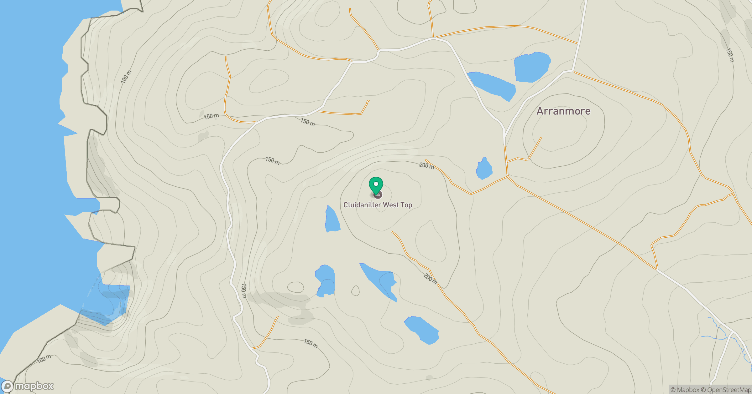
Grid reference: B653157
View on OpenStreetMapOpens a map in a new tab, centred on the hill.
No comments yet. Be the first.